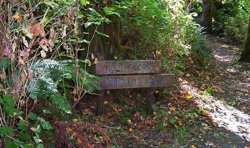

Clemens North Fork Interpretive Trail
- Trail System: Clemens County Park
- Trailhead(s): Clemens North Fork Interpretive Trail (Get Directions), Clemens North Fork Interpretive Trail (Get Directions), Clemens Seeley Creek Access Trail (Get Directions), Clemens Seeley Creek Access Trail (Get Directions)
- Season: Year-round
- Hours: Daylight
Located on the Alsea River, this park has water access, picnic areas and restroom facilities. Interpretive signage provides information about river ecology along the trail.
The North Fork Interpretive Trail parallels the Alsea River from its origin at the parking lot kiosk. This 1/4 mile trail segment offers a self-guided interpretive opportunity with 10 riparian-related interpretive stations located along this pleasant riverside pathway. Brochures interpreting the 10 stations are available at the trailhead kiosk. The forest and riparian elements presented here are typical of the Oregon Coast Range environment. Mid-way along the trail, take the time to watch the river activity from the salmon viewing deck, built as an Eagle Scout project. During spawning season salmon may be observed building their gravel nests below in order to prepare for the next generation. To return to the parking lot either retrace your steps or make a loop by taking the Sealy Creek access trail.
Trail description by: Benton County Natural Areas & Parks Department